Search -
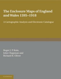
The Enclosure Maps of England and Wales 1595-1918: A Cartographic Analysis and Electronic Catalogue
The Enclosure Maps of England and Wales 15951918 A Cartographic Analysis and Electronic Catalogue
Author:
Offering a comprehensive study of the enclosure mapping of England and Wales, the authors assess the processes of land enclosure and the role of maps (the mapping of each county and the cartographic characteristics of all the maps). Accompanied by an electronic catalog of all extant parliamentary and non-parliamentary enclosure maps of England a... more »
ISBN-13: 9780521173230
ISBN-10: 052117323X
Publication Date: 1/13/2011
Pages: 435
Rating: ?
ISBN-10: 052117323X
Publication Date: 1/13/2011
Pages: 435
Rating: ?
0 stars, based on 0 rating
Publisher: Cambridge University Press
Book Type: Paperback
Other Versions: Hardcover
Members Wishing: 0
Reviews: Amazon | Write a Review
Book Type: Paperback
Other Versions: Hardcover
Members Wishing: 0
Reviews: Amazon | Write a Review
Genres:
- History >> Europe >> Wales
- History >> Historical Study & Educational Resources >> Social History
- Travel >> Europe >> Great Britain >> Wales


