Search -
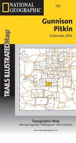
Trails Illustrated - Colorado-Gunnison/Pitkin (Colorado)
Trails Illustrated ColoradoGunnison/Pitkin - Colorado
Author:
Topographic full color Utah state map is scaled at 1" = 12.5 miles. Elevation contours each 1,000 feet (color shaded each 2,000 feet at higher elevations) portray the general geography. Also shown are national forests, wilderness areas, campgrounds, parks, state game and fish areas, ski areas, mining districts, points of interest, and more.Â... more »
ISBN-13: 9780925873521
ISBN-10: 0925873527
Rating: ?
ISBN-10: 0925873527
Rating: ?
0 stars, based on 0 rating
Genres:
- Reference >> Atlases & Maps
- Travel >> United States >> Regions >> General
- Travel >> United States >> States >> Colorado >> General


