Search -
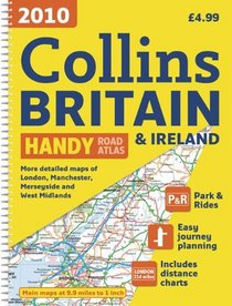
2010 Collins Handy Road Atlas Britain & Ireland (International Road Atlases)
2010 Collins Handy Road Atlas Britain Ireland - International Road Atlases
Author:
Fully updated, this atlas features maps of Britain at 9.9 miles to 1 inch and the whole of Ireland is covered at 15.8 miles to 1 inch. There is also a selection of more detailed urban area maps at 4.5 miles to 1 inch to aid route planning in these busy areas. The atlas includes road maps that focus on the main roads, motorways, and settlements; ... more »
ISBN-13: 9780007285037
ISBN-10: 0007285035
Publication Date: 12/1/2009
Pages: 80
Edition: Spi
Rating: ?
ISBN-10: 0007285035
Publication Date: 12/1/2009
Pages: 80
Edition: Spi
Rating: ?
0 stars, based on 0 rating
Publisher: HarperCollins UK
Book Type: Spiral-bound
Members Wishing: 0
Reviews: Amazon | Write a Review
Book Type: Spiral-bound
Members Wishing: 0
Reviews: Amazon | Write a Review
Genres:


