Search -
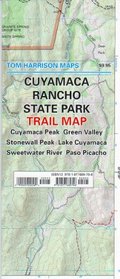
Cuyamaca Rancho State Park Trail Map
Cuyamaca Rancho State Park Trail Map
Author:
Shaded Relief Topo Map. Covers Cuyamaca Peak-Green Valley, Stonewall Peak- Lake Cuyamaca, Sweetwater River-Paso Picacho. Scale:1:31,680 (2"= 1 mile) Printed on waterproof and tear resistent material.
Author:
Shaded Relief Topo Map. Covers Cuyamaca Peak-Green Valley, Stonewall Peak- Lake Cuyamaca, Sweetwater River-Paso Picacho. Scale:1:31,680 (2"= 1 mile) Printed on waterproof and tear resistent material.
ISBN-13: 9781877689796
ISBN-10: 1877689793
Publication Date: 6/6/2003
Pages: 1
Rating: ?
ISBN-10: 1877689793
Publication Date: 6/6/2003
Pages: 1
Rating: ?
0 stars, based on 0 rating


