Search -
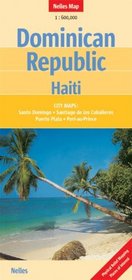
Dominican Republic and Haiti Map by Nelles (Nelles Maps) (English, Spanish, French and German Edition)
Dominican Republic and Haiti Map by Nelles - Nelles Maps - English, Spanish, French and German Edition
Author:
Folded road & tourist map for the countries of Dominican Republic and Haiti, on the island of Hispaniola, at 1:600,000 scale. Places of interest, national parks, and beaches are highlighted. Shaded-relief coloring clearly depicts topography. Insets of Port-au-Prince, Puerto Plata, Santiago, Santo Domingo, and locator map. Legend in 3 languages.
ISBN-13: 9783865740236
ISBN-10: 3865740235
Publication Date: 7/1/2007
Pages: 2
Edition: 2
Rating: ?
ISBN-10: 3865740235
Publication Date: 7/1/2007
Pages: 2
Edition: 2
Rating: ?
0 stars, based on 0 rating
Genres:
- Reference >> Atlases & Maps >> Travel Maps
- Travel >> Caribbean >> Dominican Republic
- Travel >> Caribbean >> General
- Travel >> Caribbean >> Haiti
- Travel >> Europe >> France >> General
- Nonfiction >> Foreign Language Nonfiction >> French
- Nonfiction >> Foreign Language Nonfiction >> German
- Nonfiction >> Foreign Language Nonfiction >> Italian
- Nonfiction >> Foreign Language Nonfiction >> Spanish


