Search -
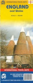
England and Wales Map by ITMB
England and Wales Map by ITMB
Author:
Folded paper road and travel map in color. Scale 1:550,000. Distinguishes roads ranging from motorways to B roads. Legend includes railways, ferry routes, county boundaries, internal borders, airports, points of interest, museums, castles, cathedrals, beaches, golf courses, National Parks, coastel points, physical features. Map includes extensiv... more »
ISBN-13: 9781553415824
ISBN-10: 1553415825
Publication Date: 11/1/2006
Pages: 2
Edition: 1
Rating: ?
ISBN-10: 1553415825
Publication Date: 11/1/2006
Pages: 2
Edition: 1
Rating: ?
0 stars, based on 0 rating
Publisher: International Travel Maps and Books
Book Type: Map
Members Wishing: 0
Reviews: Amazon | Write a Review
Book Type: Map
Members Wishing: 0
Reviews: Amazon | Write a Review
Genres:
- Reference >> Atlases & Maps
- Travel >> Europe >> General
- Travel >> Europe >> Great Britain >> England >> General
- Travel >> Europe >> Great Britain >> Wales


