Search -
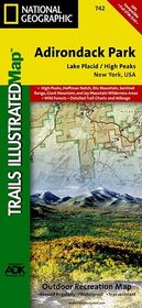
Lake Placid, High Peaks - Trails Illustrated Map # 742
Lake Placid High Peaks Trails Illustrated Map 742
Author:
Coverage includes Mt Marcy, High Peaks, Dix Mountain, Jay Mountain and Sentinel Range Wilderness Areas; Adirondack Mountain Reserve; Hurricane Mountain Primitive Area; Vanderwhacker Mountain Wild Forest; and the Northville-Lake Placid Trail from Blue Mountain Wild Forest to Lake Placid. Also includes Ray Brook, Newcomb, Elizabethtown, and Keesev... more »
ISBN-13: 9781566953573
ISBN-10: 156695357X
Publication Date: 1/1/2004
Pages: 2
Edition: 2
Rating: ?
ISBN-10: 156695357X
Publication Date: 1/1/2004
Pages: 2
Edition: 2
Rating: ?
0 stars, based on 0 rating
Genres:
- Travel >> United States >> States >> New York >> Adirondacks


