Search -
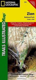
Zion National Park , UT - Trails Illustrated Map # 214
Zion National Park UT Trails Illustrated Map 214
Author:
The map of Zion National Park includes Bullfrog, Halls Crossing, Dangling Rope Marina, Rainbow Bridge, Rainbow Plateau, Wahweap, Carl Hayden Visitor Center, Glen Canyon Dam, Lee's Ferry, Hite, the Henry Mountains, Burr Desert, and much more. Includes information for hiking the Zion Narrows and has UTM grids for use with your GPS unit.
ISBN-13: 9781566952972
ISBN-10: 1566952972
Publication Date: 5/1/2005
Edition: 3
Rating: ?
ISBN-10: 1566952972
Publication Date: 5/1/2005
Edition: 3
Rating: ?
0 stars, based on 0 rating
Publisher: Natl Geographic Society Maps
Book Type: Map
Members Wishing: 0
Reviews: Amazon | Write a Review
Book Type: Map
Members Wishing: 0
Reviews: Amazon | Write a Review
Genres:
- Reference >> Atlases & Maps >> Travel Maps
- Travel >> United States >> States >> Utah >> Bryce Canyon & Zion National Parks


