Search -
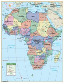
Africa Primary Wall Map Railed - 54x69 - Laminated on Rails- Identifying political country boarders, capitals, major cities, waterways and latitude/longitude lines (Primary Classroom Wall Maps)
Africa Primary Wall Map Railed 54x69 Laminated on Rails Identifying political country boarders capitals major cities waterways and latitude/longitude lines - Primary Classroom Wall Maps
Author:
This Wall Map of the African Continent by Universal Map measures 54 x 69; and ranges North to the Mediterranean Sea and Saudi Arabia; South to the Indian and Atlantic Oceans; East to the Indian Ocean and Madagascar; and West to the Atlantic Ocean. Also featured are elevations, national capitals, boundaries, and more. Includes rails on top and bo... more »
ISBN-13: 9780762517329
ISBN-10: 0762517328
Publication Date: 1/26/2010
Rating: ?
ISBN-10: 0762517328
Publication Date: 1/26/2010
Rating: ?
0 stars, based on 0 rating


