Search -
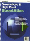
Greensboro/High Point, NC (City & County Street Atlas)
Greensboro/High Point NC - City & County Street Atlas
Author:
Full color commercial street atlas, showing complete street detail and boundaries for Greensboro and High Point, North Carolina and adjacent areas including Archdale, Greensboro, High Point, Jamestown, Stokesdale, Summerfield, Thomasville and Whitsett. Map scale is 1-inch = 2485 feet (2.1-inches = 1-mile). The maps include: all streets a... more »
ISBN-13: 9781564649577
ISBN-10: 1564649571
Rating: ?
ISBN-10: 1564649571
Rating: ?
0 stars, based on 0 rating
Publisher: Universal Map Enterprises
Book Type: Spiral-bound
Members Wishing: 0
Reviews: Amazon | Write a Review
Book Type: Spiral-bound
Members Wishing: 0
Reviews: Amazon | Write a Review
Genres:
- Reference >> Atlases & Maps >> World
- Travel >> United States >> States >> North Carolina >> General


