Search -
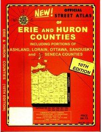
Official Street Atlas of Erie and Huron Counties: Including Portions of Ashland, Lorain, Ottawa, Sandusky and Seneca Counties
Official Street Atlas of Erie and Huron Counties Including Portions of Ashland Lorain Ottawa Sandusky and Seneca Counties
Author:
Author:
ISBN-13: 9781879116757
ISBN-10: 1879116758
Publication Date: 9/16/2005
Pages: 48
Edition: 10
Rating: ?
ISBN-10: 1879116758
Publication Date: 9/16/2005
Pages: 48
Edition: 10
Rating: ?
0 stars, based on 0 rating
Publisher: Rand McNally & Company
Book Type: Paperback
Other Versions: Hardcover
Members Wishing: 0
Reviews: Amazon | Write a Review
Book Type: Paperback
Other Versions: Hardcover
Members Wishing: 0
Reviews: Amazon | Write a Review
We're sorry, our database doesn't have book description information for this item. Check Amazon's database -- you can return to this page by closing the new browser tab/window if you want to obtain the book from PaperBackSwap.


