Search -
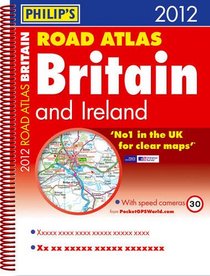
Philip's Road Atlas Britain and Ireland
Philip's Road Atlas Britain and Ireland
Author:
Philip's Road Atlas Britain and Ireland 2012 contains 160 pages of road maps covering Britain at 3 miles to 1 inch, with the Western Isles, Orkney and Shetland at smaller scales. The maps clearly mark service areas, roundabouts and multi-level junctions, and in rural areas distinguish between roads over and under 4 metres wide - a boon for drive... more »
ISBN-13: 9781849071574
ISBN-10: 1849071578
Publication Date: 7/4/2011
Pages: 224
Rating: ?
ISBN-10: 1849071578
Publication Date: 7/4/2011
Pages: 224
Rating: ?
0 stars, based on 0 rating
Genres:
- Reference >> Atlases & Maps >> Travel Maps
- Travel >> Europe >> Great Britain


