Search -
Ready-to-Use Outline Maps of the U.S. States and Regions : 159 Different Copyright-Free Maps Printed One Side (Dover Clip Art)
Ready-to-Use Outline Maps of the US States and Regions 159 Different Copyright-Free Maps Printed One Side - Dover Clip Art
Author:
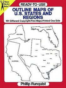
Boldly outlined maps of each state, with capitals, principal cities and primary rivers noted on each. Additional maps of each state, appear blank, in two different sizes. Also includes major U.S. regions, entire United States and global view of North and South America. Easy-to-use anthology for graphic artists, students of geography, professiona... more »
ISBN-13: 9780486280561
ISBN-10: 048628056X
Publication Date: 4/25/1994
Pages: 64
Rating: 2
ISBN-10: 048628056X
Publication Date: 4/25/1994
Pages: 64
Rating: 2
4.8 stars, based on 2 ratings
Genres:


